Tours Métropole Val de Loire leads the way in transparency by mapping its exposure to electromagnetic fields by bicycle
- 08/12/2023
- Environmental health, Exem, In my city, News
As part of its strategy to manage the risks associated with electromagnetic fields, and as part of its commitment to transparency, Tours Métropole Val de Loire teamed up with EXEM to map electromagnetic exposure in Tours city center on December 7th.
Committed in monitoring and measuring electromagnetic fields, in particular via the EMF Observatory, this metropolis is one of the pioneers in France in the implementation of such operations. Maria LEPINE, 1st Vice-President in charge of Digital Transformation for the region and Mayor of Villandry, and elected representatives from the municipalities taking part in the 5G Action Plan Steering Committee, were also present at this initiative.
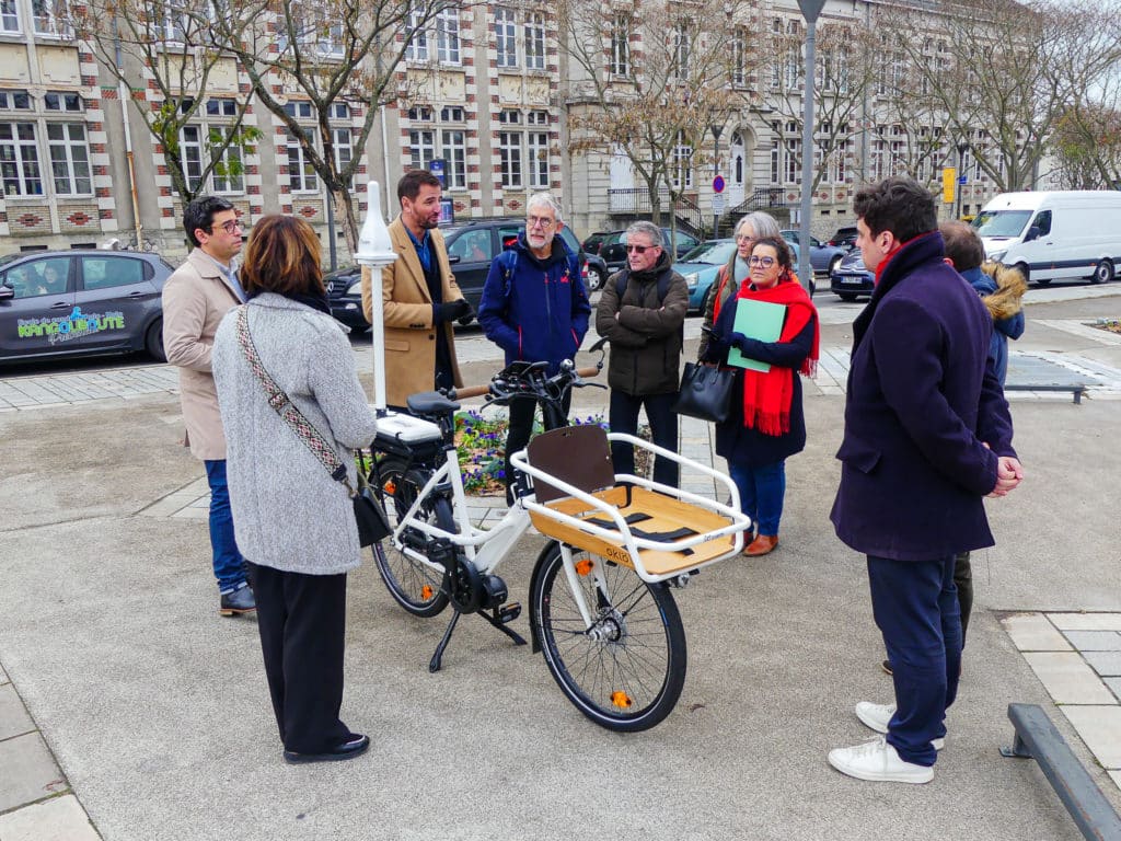
A low-carbon approach to cartography EMF exposure
EXEM’s EMF City Map solution is based on a sensor technology embedded on an electric bicycle, enabling measurements of exposure to electromagnetic fields to be taken while riding. This approach provides a complete mapping of the territory at road level. The results are presented on an interactive map, making it easier to identify areas requiring follow-up action. In addition to its low-carbon credentials, cycling ensures a constant speed, whatever the road surface.
The method, which consists of measuring exposure levels every 2 meters at a stable average speed of 20 km/h, has enabled us to collect several thousand measurement points over a targeted area of the city, representing some 65 kilometers of linear street.
Why map EMF exposure?
François De Las Heras, in charge of the Sustainable and Connected Territory Mission at the Digital Transformation Department, was attracted by this innovative solution and wanted to have a global view of the exposure in order to identify potential areas of overexposure.
The EMF City Map solution enables Tours Métropole Val de Loire to obtain a 2D colour map of levels of exposure to electromagnetic waves, accessible online for greater transparency on the electromagnetic environment of the metropolitan area.
Towards a global approach to EMF-related environmental health
EXEM’s mapping tool meets the needs of both local authorities and telecoms operators involved in territorial digital deployment. This offer therefore represents an opportunity for local authorities to adopt an innovative environmental health policy, taking into account both short- and long-term electromagnetic exposure challenges. The approach also enables public players to position themselves objectively in exchanges with stakeholders.
EXEM also offers a comprehensive range of services for local authorities: EMF City ManagementThis includes a network coverage mapping solution to take account of the government’s recommendations, urging users to make calls in good network coverage conditions to reduce their exposure to mobile terminals.
Conclusion
The EMF City Map solution and Tours Métropole Val de Loire initiative pave the way for an innovative and responsible approach to managing exposure to electromagnetic fields in constantly changing urban environments. The initiative contributes to the overall objective of sustainable environmental health, and is in line with the 5G Action Plan adopted by the Metropole and all the local authorities in the area in 2022. It also enhances the actions already undertaken, via the EMF Observatory, with its 5 EXEM sensors in place.